

What is Modsim-DSS?
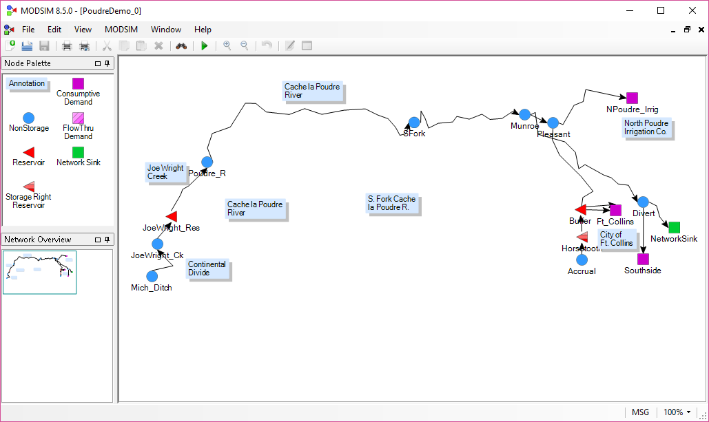
MODSIM-DSS is a generalized river basin Decision Support System and network flow model developed at Colorado State University designed specifically to meet the growing demands and pressures on river basin managers today.
Rapid growth in population centers and mounting needs for irrigation have dramatically increased the need to expand sources of reliable water supply, while attending to environmental and ecological issues. Publically owned water systems must often deal with severe restrictions from complex legal agreements, contracts, federal regulations, interstate compacts, and pressures from various special interest groups. Optimal coordination of these many facets of river basin systems requires the assistance of computer modeling tools to make rational management decisions.
MODSIM-DSS was designed for this highly complex and constantly evolving river basin management environment.
MODSIM-DSS has been linked with stream-aquifer models for analysis of the conjunctive use of groundwater and surface water resources.
MODSIM-DSS has also been used with water quality simulation models for assessing the effectiveness of pollution control strategies.
MODSIM-DSS can also be used with geographic information systems (GIS) for managing spatial data base requirements of river basin management.
MODSIM-DSS is structured as a Decision Support System, with a graphical user interface (GUI) allowing users to create any river basin system topology. Data structures embodied in each model object are controlled by a data base management system, which is also queried by simple mouse activation. Formatted data files are prepared interactively and a highly efficient network flow optimization model is automatically executed from the interface without requiring any direct intervention by the user. Results of the network optimization are presented in useful graphical plots.